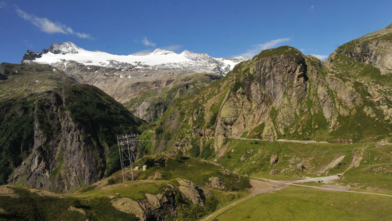
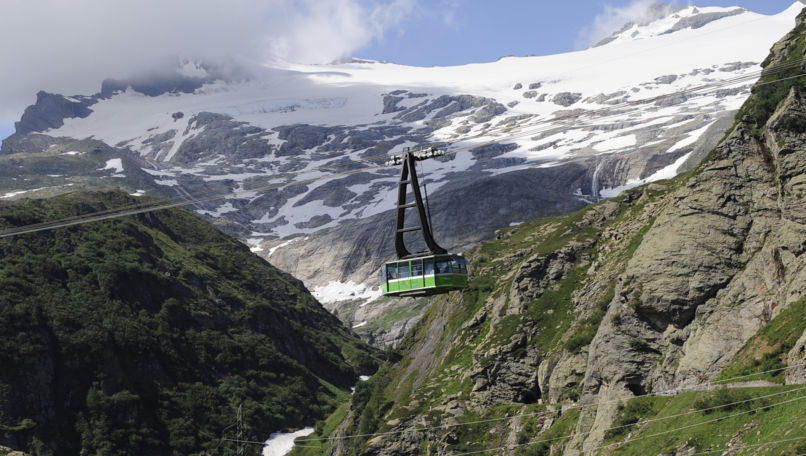
At the head of the wild Bavona Valley, where sheer granite walls frame an elemental world of ice, rock, and sky, the Basodino glacier clings to the mountainside as it has for millennia, though its days grow numbered. This is Ticino's largest, most studied, and most accessible glacier, and the glaciological trail that encircles it offers a profoundly moving encounter with a landscape in transformation. The journey begins far below in the beautiful Bavona Valley, winds through San Carlo, and rises by cableway to the high plateau of Robiei, where alpine pastures, rare wildlife, and the raw beauty of the glacial frontier await.
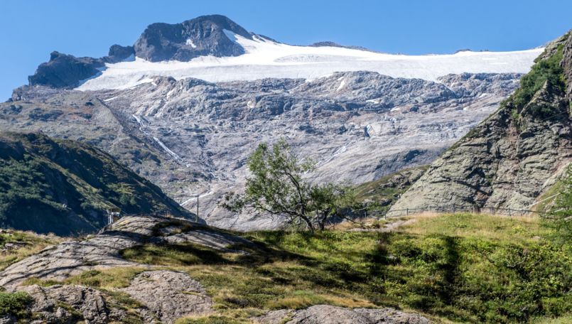
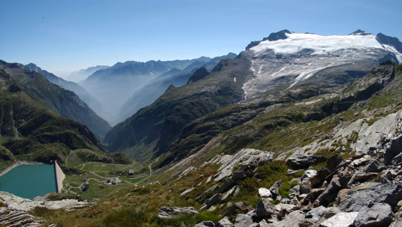
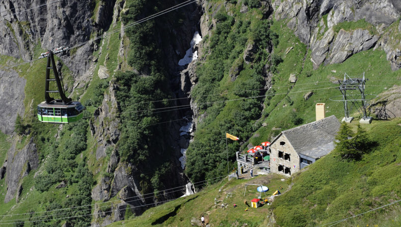
The cableway to Robiei was built by the hydroelectric company of Maggia, which also constructed the dams that collect water for the region's power plants. The Basodino glacier spans approximately 2 square kilometres between 2,500 and 3,120 metres, but like most Alpine glaciers, it is retreating rapidly. Scientists warn that within a few years only scattered remnants of ice may survive on the highest crests, making every visit to this frozen landscape feel both precious and urgent.
The ideal time to experience the area's rich alpine flora is between July and August. The cableway operates from mid-June to early October. The high valleys teem with life: ibex, chamois, marmots, mountain hares, the rare ermine, field mice, and numerous bird species including the majestic golden eagle. Scattered mountain huts, old farmsteads, and sprugh (shelters carved beneath massive boulders) speak to the vital importance of high pastures on these mountains. The glaciers have long exercised their magnetism: already at the end of the 19th century, Federico Balli commissioned the Hotel du Glacier in Bignasco, at the gateway to the valley, to welcome tourists drawn by the Alps and the perennial snows of Basodino.
Itinerary: Robiei Glaciological Trail (6h, see map)
From San Carlo in the Bavona Valley, take the cableway up to Robiei. The glaciological trail unfolds through an alpine environment reaching 2,430 metres, with both departure and return at Robiei (1,890 m). A 15-minute walk on a paved road from the cableway station, passing through two short, well-lit tunnels, brings you to the Lake Zott dam. From there, the trail ascends to the crest of the right orographic moraine of the Basodino glacier, the route's highest point. It then traverses the broad rocky plateau nearly horizontally beneath the icy facade of the left orographic moraine, before descending back toward Robiei through the courtyard of Randinascia.
While not technically demanding, some sections require caution, particularly when crossing snowfields and watercourses. Follow the indications in the guidebook carefully. As with any white-and-red-marked Alpine trail, appropriate footwear and gear for the mountain's changeable weather are essential.
Educational visit of the Robiei dam
Thanks to an initiative by the Ofima utility company, the tunnel inside the Robiei dam is now open to the public, offering a rare chance to step inside one of the imposing concrete structures that have reshaped the high Bavona landscape. The educational itinerary explains how dams integrate into the water's natural cycle, illustrates different construction techniques and security controls, and reveals how the raw force of water is transformed into electricity. This unique walk through the dam's tunnels is free of charge. Collect the access key from the Robiei Hotel in exchange for ID. The temperature inside hovers around 8 degrees Celsius with high humidity, so bring warm layers. Duration: approximately 30 minutes.
You might also like
Trekking
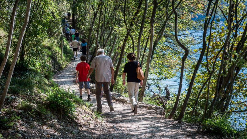
Around Monte Caslano
A pleasant walk on the shores of Lake Lugano allows you to explore the peninsula of Caslano, a typical Ticino village, dominated by a hill of 500 meters.
Trekking
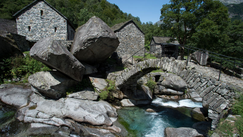
Bavona Valley
Bavona Valley, which branches off from the Maggia Valley, is characterized by its wilderness.
Trekking
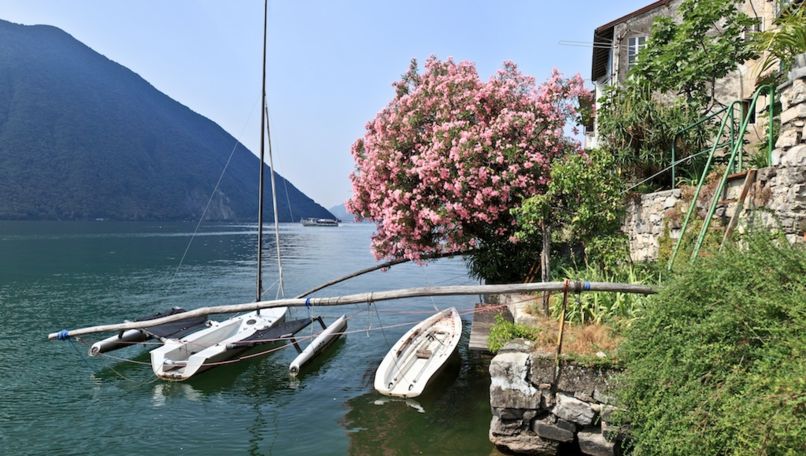
Gandria Trail
The Sentiero di Gandria (Gandria Trail) is a "must" for those vacationing in the Lugano Bay.